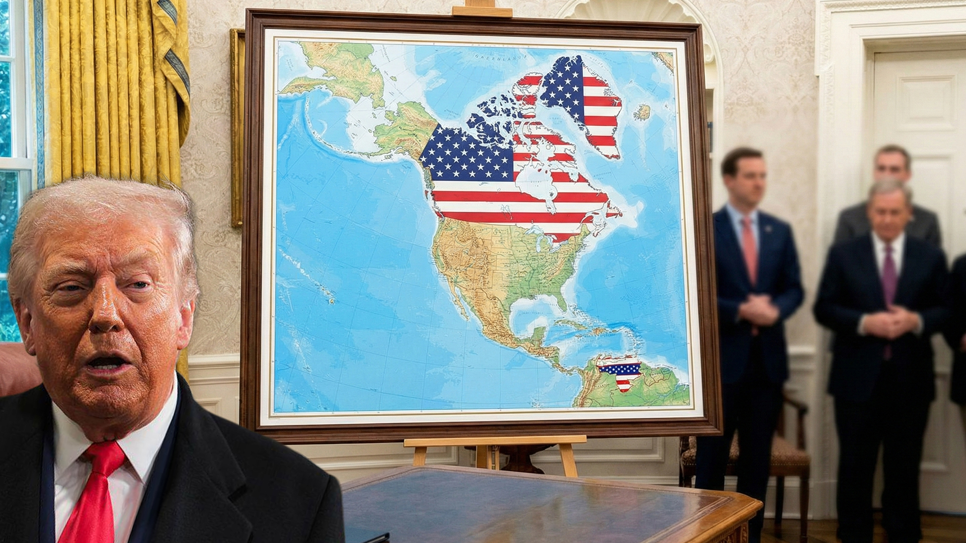
President Donald Trump recently posted an altered map online that showed Greenland, Canada, and Venezuela as US territories. The images appeared to be AI-generated, with American flags marking regions that are not under US control. One picture even showed Trump and other officials standing beside the map, while another depicted him planting a flag in Greenland, labelled “Greenland US Territory Est. 2026.”
The posts have drawn widespread attention on social media, with reactions ranging from amusement to concern. Many users pointed out that the images were clearly fictional, while others criticized the posts as provocative and diplomatically insensitive.
Trump has previously expressed interest in Greenland, emphasizing its strategic importance for the United States. Greenland is an autonomous territory of Denmark, whose government has repeatedly stated it has no intention of joining the US. The inclusion of Canada and Venezuela on the map added further controversy. Trump has jokingly suggested in the past that Canada could become a US state, a proposal firmly rejected by Canadian leaders. Venezuela’s appearance comes amid ongoing political tensions in the region, adding another layer of sensitivity.
Diplomats and European leaders have taken notice of the posts, with some calling them a “provocative stunt.” While the images were likely intended for online engagement, they have nonetheless sparked debate about international relations and territorial respect.
The map also comes at a time when Trump is preparing to engage with global leaders at the World Economic Forum in Davos, where discussions on diplomacy, security, and trade are expected to take centre stage. Analysts say the posts highlight Trump’s flair for attention-grabbing social media moments that often blur the line between reality and performance.